
Pen y Darren [Moel Hyddgen]
Good walks are even better shared.
Overview
Pen y Darren [Moel Hyddgen]
Overview
Nestled in the heart of the Welsh countryside, Pen y Darren, often affectionately known as Moel Hyddgen, stands proudly at 598 meters. This mountain is a hidden gem for those keen on exploring scenic hikes away from the crowds.
Geology
The geological story of Pen y Darren is one of ancient seas and sedimentation. Comprised mainly of Devonian mudstones and sandstones, the mountain showcases the wonders of nature's handiwork. It's a rocky playground, perfect for budding geologists or those simply interested in marveling at the Earth's history!
Routes
The most popular route begins at the southern trailhead. Spanning 4.5 kilometres, it's a moderate trail that offers uplifting views as you ascend. This route will test your legs but will reward you with a sense of achievement and sweeping vistas once you reach the summit.
Summit Features
Upon reaching the summit, hikers are greeted by a trig point and a well-constructed stone cairn. It’s practically begging for a photo, so prepare your best victory pose!
Terrain Type
Expect a delightful mix of rocky and grassy patches, though be wary of the occasional bog. Yes, I said 'bog'—nature’s way of keeping you on your toes!
Views
Once at the top, the views are nothing short of breathtaking. The Dyfi Valley stretches below, with the Cambrian Mountains towering in the distance. On clear days, you might even spy Snowdonia’s giants, flaunting their allure. Early mornings in late spring through early autumn are prime times for the best snaps, with a misty backdrop that's straight out of a fairytale.
Hazards
Every adventure has its risks! Be mindful of the unpredictability of Welsh weather. Those sudden downpours can turn paths slicker than a politician on a chartered yacht. And don’t forget to share the trail with the local sheep—the original guardians of the hills!
Nearby Summits
Moel Hyddgen is surrounded by other prominent peaks, including Cadair Idris to the south and Pumlumon to the east, making for a perfect multi-summit adventure if you’re up for it!
Access
Getting to this splendid mountain isn’t too tricky. The closest parking is found at the southern trailhead off the A487, though it does fill up fast on sunny weekends. If you're relying on public transport, buses run from Machynlleth to Pantperthog—a charming start to your hike!
Facilities
While Pay y Darren may not boast any facilities, nearby Machynlleth is more than equipped with cafes and public toilets. So grab a cup of tea or coffee before or after your hike!
History
The Welsh love their etymology, and the name 'Pen y Darren' tells the tale of an oak-laden hillside, a nod to what the landscape might have looked like centuries ago. This mountain has been embraced by locals and outdoor enthusiasts alike as a slice of paradise.
In conclusion, Pen y Darren [Moel Hyddgen] offers an invigorating challenge paired with spectacular views and rich history! Whether you're taking your first steps into hiking or you're a seasoned vagabond, this mountain has something for everyone.
Happy hiking!
Explore routes near Pen y Darren [Moel Hyddgen]
Public walks starting within 80 km of this hill. Nearby does not mean a route reaches the summit; check its map and access before setting out.
Hafren Forest: full Source of the Severn Trail
View route
Cadair Idris - Pony Path
View route
Waun-oer, Maesglase and Cribin Fawr guided mountain walk
View route
Ystwyth Trail: Black Covert to Llanilar and back
View route
Route planning notes
These notes describe possible approaches, not verified navigable routes or permission to cross land. Check current paths, local access rules and conditions before setting out.
From the Southern Trailhead
This steep ascent begins from the southern trailhead and offers sweeping views of the surrounding hills and valleys as you rise.
Make a day of it, together
Find someone to share the walk with, or organise a day out along a route you like.
Hill facts and local notes
Classifications
Elevation
529m
1,737 ft
Prominence
105m
Coordinates
52.5325, -3.8231
SN764942
OS Map
135
Explorer: OL23W 215W
At the Summit
The summit features a prominent trig point and a small stone cairn, both perfect for a summit selfie or a nice rest stop to catch your breath, or perhaps catch a bird or two's eye.
Terrain & Geology
The mountain is composed of mudstones and sandstone from the Devonian period, offering a mix of rugged terrain and soft, grassy slopes. It's a geologist's welcome mat.
Views & Scenery
From the peak, you can enjoy views of the Dyfi Valley, the Cambrian Mountains, and on a clear day, even the mighty Snowdonia in the distance.
History & Heritage
Name Origin
The name 'Pen y Darren' translates to 'Head of the Oak Hill', reflecting the area's lush vegetation in the past.
Historical Significance
Historically, the mountain has been a beacon for local wildlife enthusiasts and hikers alike, serving as a challenge and an adventure spot.
Getting There & Facilities
Check current local access restrictions, parking rules and transport timetables before travelling. These notes do not confirm public access to the summit.
Parking
There is limited parking at the southern trailhead off the A487 road, which can fill up quickly on a sunny weekend.
Public Transport
Buses run from Machynlleth to the nearby village of Pantperthog, where a short walk will lead you to the trail.
Nearby Facilities
While there are no facilities directly at the mountain, Machynlleth offers cafes and public toilets, so stock up before you trek.
Safety Information
Known Hazards
- Watch out for sudden weather changes, the occasional roaming sheep, and the slippery paths, especially after rain.
General Safety Tips
- Check weather conditions before setting out
- Carry appropriate clothing and equipment
- Let someone know your planned route
- Take a map, compass, and GPS device
- Carry emergency supplies: food, water, first aid kit, torch
Hills
Some common questions about the hills answered
Are there group walks up Pen y Darren [Moel Hyddgen]?
Many walkers use Walkmates to join or organise walks with others. You can check for group walks around Pen y Darren [Moel Hyddgen] through the maps
Are there other walkers around Pen y Darren [Moel Hyddgen]?
Activity varies by location and time, but Walkmates lets you see whether others have shared walks or shown interest in this area. Find other people through the walking friends search walking friends for Pen y Darren [Moel Hyddgen] search or of course create your own walk for Pen y Darren [Moel Hyddgen]
Can I organise a walk to Pen y Darren [Moel Hyddgen]?
Yes. If there aren’t any walks listed already, you can create a walk and make it available for others to join.
If you're signed up to Walkmates, you can create a walk to Pen y Darren [Moel Hyddgen].
How do I find a walk up this hill?
There are often multiple ways to walk this hill, depending on experience and route preference. Walkmates helps you explore walks and routes that others have shared.
Can I suggest a new route up Pen y Darren [Moel Hyddgen]?
Yes. You can suggest or create routes to share with others. Walkmates focuses on the social side of walking, so routes are used to help people organise walks and explore areas together, rather than as detailed navigation tools or route libraries.
Other uses really appreciate knowledgeable walkers sharing their routes. Share your favourite route to Pen y Darren [Moel Hyddgen] here
The is an error or something incorrect about this hill. How do I let you know?
We always strive to keep the information on Walkmates as accurate as possible. If you find an error, please let us know through the contact form and we'll aim to correct it as quickly as possible
Community Discussion
Comments
Location
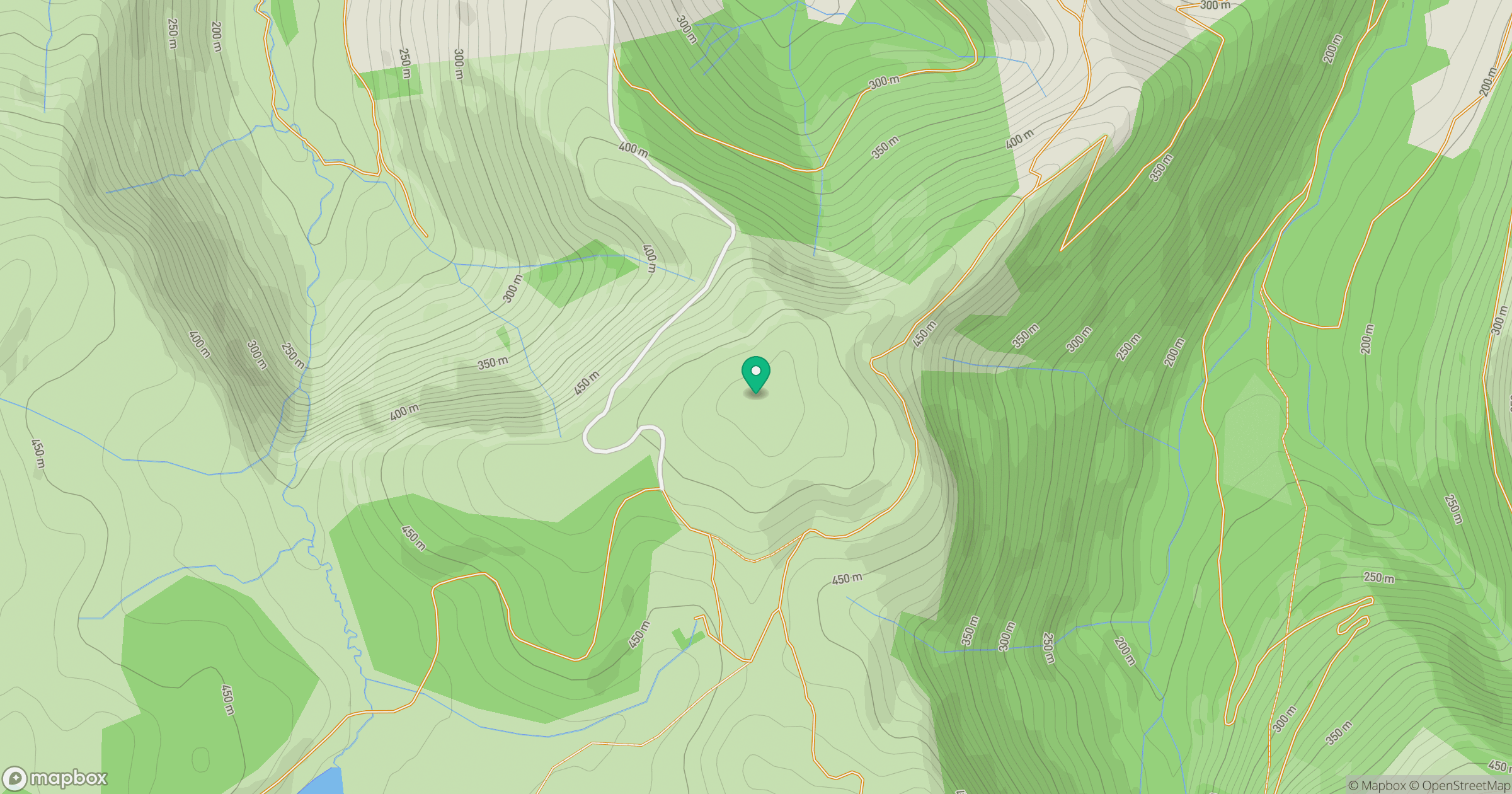
Grid reference: SN764942
View on OpenStreetMapOpens a map in a new tab, centred on the hill.
Hills within 30 km
Straight-line distance, not a walking route or confirmation of access.
Pumlumon Fawr [Plynlimon]
753m
Cadair Idris - Penygadair
893m
Y Garn
629m
Aran Fawddwy
906m
Pen yr Allt-fawr
316m
No comments yet. Be the first.